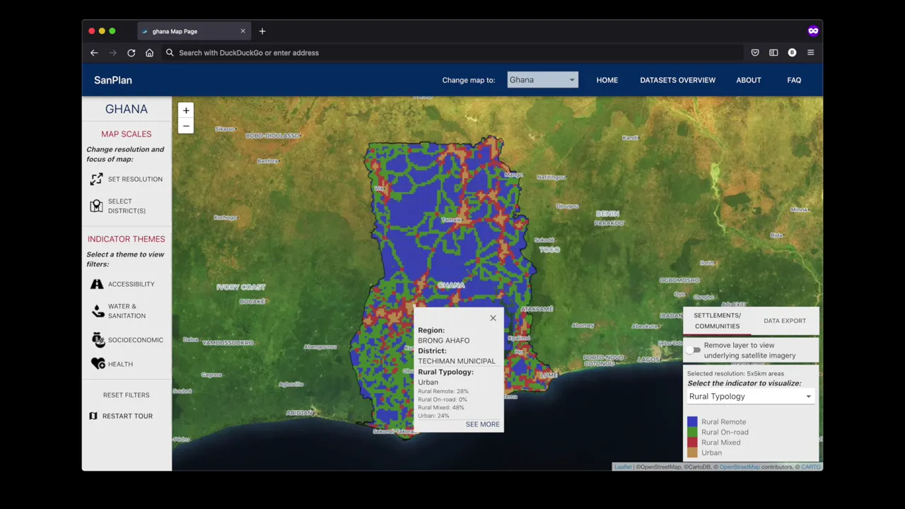
The Sanitation Planning Web Platform is a data visualization and mapping interface developed for Aquaya that empowers governments, donors, and implementing organizations to utilize geo-referenced data for targeted rural sanitation interventions. This platform is meant to bridge the gap between data collection and actionable insights in the water, sanitation, and hygiene (WASH) sector.

As the lead product designer and technologist, I developed a comprehensive web platform powered by CARTO’s GIS capabilities that transforms complex sanitation data into accessible, actionable visualizations.
Key responsibilities in the development of this platform:
- Translated field research, technology constraints and security criteria into a cohesive and actionable product design and technology implementation strategy
- Developed the MVP roadmap and sprint planning framework
- Co-designed Ux, UI and Data Visualizations within the product
- Architected the technical integration with CARTO to enable advanced mapping and visualization capabilities
- Provided web development expertise and mentoring to the development team
The platform we developed enables users to explore interactive maps while juxtaposing several socio-economic indicators. Decision-makers can visualize geographical patterns, filter data based on various parameters, and identify priority regions for targeted action — all through an intuitive interface designed for both technical and non-technical users.